Dawn, July 18, 2019 – Four Corners Regional Airport. RizAir1 is loaded to the gills. Four adults, bags, other paraphernalia, maximum fuel available after deducting the weight of everything else. Weather briefed, VFR flight plan filed. Ready to head to AirVenture 2019. Weeks of carefully planning fuel stops, finding the best fuel prices, and other preparation were completed. Approaches at the expected fuel stops and nearby fields had been practiced several times on the XPlane 11 flight simulator.
It would be a full day with almost 8 hours of flight time block to block planned. (Block to block is the time the airplane starts moving after engine start to engine shut-down “in the blocks” at the destination.) Eight hours flying may seem a long time, but airplanes are time machines. It would take us over 24 hours of driving over two very hard days to make the same trip. One purpose of this particular blog is to give insight into the planning and flexibility required for long-distance flying in private aviation.
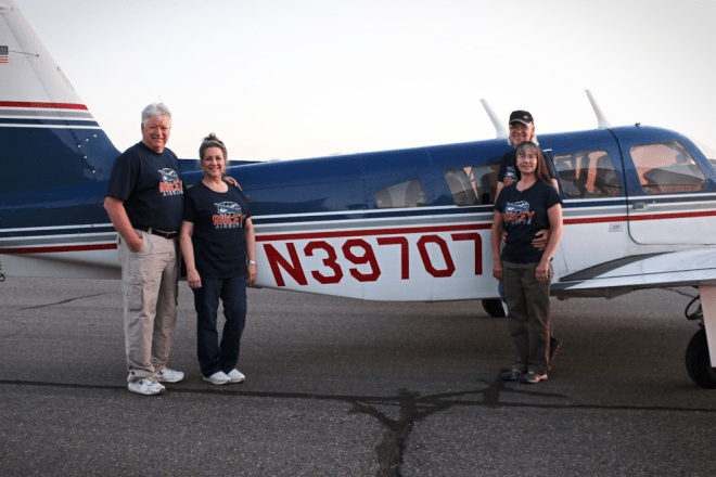
Ed and Jeanne Notson joined my wife, Annette, and me for the trip. Ed had been flying with me quite a bit in the last year as a safety pilot for instrument practice. For a trip like this, it is great to have an experienced person beside you to help lighten the load. More on that subject as further details of the trip are described.
Everything loaded, the plane is pre-flighted, the obligatory picture is taken, and we climb aboard.
The first leg of the trip was planned for just under 3 hours to Hill City, Kansas for fuel.
Those mountains that make for such scenic photographs in the Mountain West also serve as somewhat of a roadblock to transportation; whether the mode of transportation be ground-based or flies through the air. Our first leg would require us to go to the maximum altitude we would reach on the outbound trip. We flew a 072-degree heading from the Rattlesnake VOR along V368 to the intersection in the sky known as Brazo. At Brazo, we continued to follow V368 on an approximate 040-degree heading to the Alamosa VOR (ALS). You may ask why we did not fly to ALS direct and follow the GPS there? ALS lies in the San Luis Valley, and on each side of it are tall mountains. By doing the dogleg via Brazo we were able to stay below an altitude that would have required me to go on oxygen and possibly have to supply it so the passengers. I like to preserve my small oxygen bottle for “have to” circumstances. The dogleg adds less than 5 minutes to the trip.

After crossing the ALS VOR, we followed Victor Airway 83-210 through La Veta Pass, the gateway through the mountains east of Alamosa. I have previously described this pass and the tall terrain either side of it in Flying Angels Around part 2 – or Thank Goodness for Turobcharged Airplanes! (https://rizair.blog/2018/12/10/flying-angels-around-and-outsmarting-the-weather-part-2-or-thank-goodness-for-turbocharged-airplanes/.)
As we crossed the pass and reached GOSIP intersection, an inquiry to Denver Center revealed that the military operations areas (MOAs in the vernacular) were “cold”; that is, they were not in use. We then turned direct for Hill City (KHLC). A few minutes beyond GOSIP, I felt a tap on my shoulder. It was my wife. “I need to go to the bathroom,” she announced.
Good grief! Really! (I have already talked about how much extra take-offs and landings cost in “Of Airplanes and In-laws” https://rizair.blog/2018/07/31/of-in-laws-and-airplanes/). All the things you tell your kids on long car trips went flying through my mind: “I told you to go before we left. Well, you are just going to have to hold it!” Etc. Etc. On all our trips over the years, this had not happened since she was almost nine months pregnant with our first son and we were in a Mesa Airlines Cessna Caravan headed to Abilene from Farmington. Our son is now more than 30 years old!

But when nature calls, we are obligated to answer, so I quickly looked for the nearest point to divert – La Junta, Colorado (KLHX). It still was going to take most of thirty minutes to get the plane into the blocks, so she was ordered to sit back, cross her legs, and hang on until we got there. So with this little, unexpected diversion, three weeks of flight planning for the trip went out the window.
Apparently, La Junta is a popular place for the Air Force cadets to go as they learn to fly. I am always nervous flying into an uncontrolled airport which has significant student pilot traffic. Are they making the right calls? Are they making calls at all? Do they even know where they are? Do they understand that higher performance aircraft need wider traffic patterns and they should not be cut-off? Do they understand that a heavier, high performance airplane probably is not going to make the first intersection to turn-off the runway?
We managed to work our way into the pattern with the Air Force cadets, we did not run over anyone, and no one ran over us. Better yet, we did not have any unpleasant “spills” to clean-up in the back!
Well, one thing you need to be when flying in private aviation is flexible. The balance of the pre-prepared flight plans that were set up and ready to go in my Garmin Pilot app were now rendered useless. (I guess we could have made the hour-long hop to KHLC, landed, and fueled there, but, again, that is an extra stop.) So instead, I sit in the lobby of the FBO at KLHX experimenting with routes (and looking at fuel prices) that would still get us to Stevens Point, Wisconsin without an extra stop.
I discussed my thoughts with Ed, and we decided to head to Fremont, Nebraska. Actually, instead of picking the main airport (KFET), we noticed Scribner State University had its own airfield and the information we looked at said it had fuel at a good price. We filed VFR, were wheels up at 9 a.m. MDT, and quickly climbed to our desired altitude of 11,500 feet. About half-way in the three hour flight, I am reviewing what used to be called the Airport/Facilities Directory (now called the Chart Supplement), and it was then I discovered in the fine print that Scribner State was no longer selling fuel to the public. Good thing I looked because we were going to be right at my personal minimums when we got there.
A quick call to Kansas Center and we notified them of the change of destination to KFET. Fuel was more expensive there, but we knew for sure we could get it. We landed at the nice facility which is Fremont, ate lunch (Annette and I mooched off a pilot group which was grilling up hamburgers that day), fueled and filed IFR for Stevens Point, Wisconsin (KSTE.). The upcoming leg is an example of why an IFR rating is important for pilots in private aviation.
Why Stevens Point and not direct to Waupaca where the Piper formation group was meeting? Rental Car. This was the closest location to OSH that had a rental car that would not charge a king’s ransom for it. The rate we paid for the whole week equaled one or two days of rental at OSH proper.
There was a stratus layer that started about half-way to Stevens Point. The tops were around 4 to 5 thousand feet and the bases between 1200 and 1500 feet. We would be flying over the top of the clouds for most of the trip and would have to shoot an approach into KSTE.

Of the 2.8 hour trip, we spent about 36 minutes in the clouds. The flight was smooth, and the let-down into the cloud tops uneventful. Stratus layers are usually very stable air. I asked for and received the RNAV approach to Runway 21 (which I had practiced several times on the flight simulator), and we broke out at about 1300 feet above ground level. Ed called the runway in sight shortly after we broke out, but I stayed on the instruments for another 300 to 400 feet of descent to make sure we were well clear of the cloud bottoms. Man, it was nice to have that second set of eyes! We left a beautiful sunshiny day above and landed in a gray, gloomy afternoon with the threat of rain. We were on the ramp at 3:30 MDT.
The rental car was obtained with a bit of delay, but all went well. Annette drove the car to Waupaca. After evaluating the weather, since the bases had risen to at least 1500 feet and were continuing to rise to 2000 feet AGL, we decided to “scud-run” to Waupaca instead of filing IFR. The estimated time in the air would be less than 20 minutes. A careful check of the sectional showed that we would be able to stay clear of obstacles. We were airborne at 4:45 MDT and on the ground at 5 pm MDT.
As we were coming in, we heard a group of Cherokees to Oshkosh pilots landing after doing a practice formation flight. It was a joy and exciting to hear! The next day we would do the practice flight and Saturday we would head into Oshkosh itself! But alas, that story (and video) is for the next blog!

We located a couple of the CtO pilots at the airport, said hello, got current information regarding that evening’s activities, and then headed to the hotel in our rental car. We were all anxious to make new friends, practice formation flying, and then experience the event reverently called “Oshkosh” by pilots.
Adventure awaits!
Until next time:
Clear Skies and Tailwinds
Gary Risley
RizAir Blog 15
February 2020
Copyright 2020 by Gary Risley

I enjoyed your blog. My son and I made the trip to OSH back in 2017 in our new to us ’77 Grumman Tiger AA-5B. We bought it in November of 2016 and we’re based out of KBJC, located about 20 nm north of Denver, Colorado. It was the first time for me flying in and my son’s first time ever. He was a brand new private pilot at the time, (passed his check ride in June of 2017). He’s now instrument and commercial rated with over 600 hours at just 22 years old. I got my certificate while in the Navy 30 or so years ago, but took a break from flying after leaving the Navy to help raise my kids and do life with the wife, etc. Anyway, I enjoyed your story.
Fly safe and fly often!
LikeLike
Thanks for your comment on the previous blog. I hope you find the current one about our formation flight into KOSH interesting as well.
LikeLike
Also, if Airventure 2021 comes off (who knows in these times), several Grummans flew in with the Cherokees. You should plan on joining them next year. Be sure you sign up early and make it to a mini-clinic beforehand!
LikeLike