Of Bucket Lists and Airplanes

Osh 2019 Gary Annette Brown ArchBy Gary Risley

What do you get when you mix World War I replica aircraft, vintage aircraft dating all the way back to the 1930’s , World War II and Korean era warbirds, Cessnas, Pipers, Beechcraft, mixed with homebuilt airplanes, Cirrus aircraft, spacecraft, modern military cargo planes, tankers, bombers, and fighters, along with helicopters, gyrocopters, and ultralights,  private jets and more?  You get the Experimental Aircraft Association Airventure – the world’s largest airshow/aviation gathering in the world.  To the aviation community, it is simply known as “Oshkosh” for the town in Wisconsin where it is held every year.

If it is related to aviation, it is most likely will be at Oshkosh.  There are so many alphabet soup organizations and government folks that probably every letter in the alphabet is used.  If an aircraft is manufactured for private aviation use, that company will, or should, be there.  If a person has a vision for a new personal aircraft type, the chances are that it will first be presented at Oshkosh.  Need to buy anything from a nut or bolt to a whole new avionics system? You can do that at Oshkosh.

Want to see the people who actually made the history you have studied?  You can do that as well.  Want to try to try to land an airliner as a private pilot or a non-pilot like they do in the movies?  You can take a turn in the simulator to see if you can get the airplane on the ground.   Want to improve on weaknesses in your pilot skills, the Redbird simulators with instructors will run you through the wringer.  Want to participate in building an airplane that will later fly?  Show up and help “git ‘er done!”

Oshkosh is the busiest tower in the world for the week of AirVenture.  Annually more than 10,000 aircraft come to “Mecca” and probably hundreds, if not thousands more, land at near-by airports.  The organized chaos of VFR arrivals via the “Fisk” arrival corridors is an amazing thing to see and experience.  (Do a search for “Fisk Arrival” on YouTube.) Somehow, it all comes together.  Pilots better practice those landings because there are thousands of critics watching!Oshkosh Control Tower Shot

While Oshkosh is an opportunity for aviators to get together for a big reunion with over 100,000 of their closest friends, it has a lot to offer to non-aviator types.  The vastness, the expanse, and the variety of aircraft is beyond description.  An appreciation for the courage of WWI pilots can be obtained by seeing the replicas of aircraft from that era or demonstrations of the actual engines they used.  If you like science, electronics, cutting edge technology, or mechanical things: there is something at Oshkosh for you.

German wwI Fokker Fighter

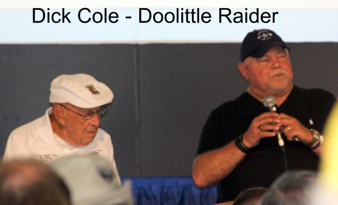
For history buffs, the frequent seminars and lectures presented throughout the day by those who lived the events or who are experts in the area will keep one hopping.  Your writer was able, for example, to attend a presentation by Dick Cole before he passed away.  Mr. Cole was Jimmy Doolittle’s co-pilot on the historic raid on Japan (Doolittle’s Raiders) and was the last of those heroes to pass away.

Dick Cole - Doolittle Raider with Text

Your writer also had the privilege of meeting two of the Tuskegee Airman last year and obtained their autographs in a book he purchased.  To hear these men speak so calmly and matter-of-factly about what they had to overcome (no one thought they could succeed) to establish themselves as some of the most elite aviators of WWII highlights is why they, and others that served in that war, are called the “Greatest Generation.”

This year (2019) Burt Rutan, an innovative aircraft designer,  was honored.  His brother, Dick Rutan, (one of the pilots for the non-stop, non-refueled flight of the Voyager around the world spoke a at Oshkosh again this year.

How about a ride in the model of helicopter that was used in Korea as made famous by the M.A.S.H television show?  You can do that at OSH.  Do you have a relative who was in the Army Air Corp in WWII?  You can grab a ride in a B-17 bomber from that era.  Want to know how the other half lived in the Guilded Age and during the early airline passenger years?  Hitch a ride in a Ford Tri-Motor.

Every child loves airplanes, helicopters, and other aircraft.  EAA has set up a special area set up at the Pioneer Airfield area with lots of education, but fun, activities for the children.   Hands-on learning is emphasized.

Have a teenager or young adult interested in an aviation career?  There are people at Airventure who will explain the ins and outs of becoming a pilot, mechanic, dispatcher, or entering another career field in aviation to them.

Room reservations?  Those reservations need to be made 9 to 12 months in advance.  You may have to stay in a hotel in another town if you delay, but Wisconsin has picture post-card countryside and friendly people, so the drive in should be pleasant if you have to stay at a distant location. Camping is also available at several locations near the airfield, and many of the campgrounds and RV parks have shuttle buses that will run you back and forth to the field for a nominal fee.  Those who fly in may camp on the field based upon space available.

IMG_1969

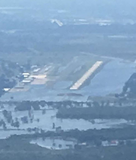
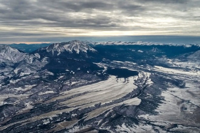
(Photo Courtesy of Ed and Jeanne Notson)

Most of all, Airventure is simply a good time where one is surrounded by good people.  People of all political views, all races, ethnic backgrounds, and religions can come together at Oshkosh and share the great passion they have for aviation.  Politics (except for those advancing the cause of aviation) are left at the gate.  One famous movie star who is a pilot noted that he enjoys landing at an airport and pulling up a chair to visit with the local “hangar rats” because he is not a movie star: he is just another pilot who likes to talk airplanes.

If it is not on your bucket list, AirVenture should be.  One cannot comprehend the Grand Canyon until one sees it.  One cannot comprehend the thing called “Oshkosh” without having been there.  Airventure is not an event, it is an experience.  It is held the last week of July every year.  Come see what makes it unique.

Mars fire bomber Oshkosh

Clear skies and Tailwinds,

Gary Risley

RizAir Blog 13 August 25, 2019    ©Gary Risley 2019

All photos by the author unless otherwise acknowledged.

A Gross Error In Judgment!?? Or What Happens When You Turn Your Wife Loose Inside Your Airplane

RizAir1 in the buff

It seemed like a good idea at the time.  A simple, straight-forward task.  Using the wife’s skills to complete a task and get her to have an “investment” in the airplane.  Ahh, but the best made plans of mice and men often gang awry as Robert Browning warned us!  Something simple, not too expensive, soon spun out of control.  Truly, a gross error in judgment.  Here is the story:

When we purchased RizAir1 it came with window tinting on the windows in the passenger cabin.  The problem was that it was automotive window tinting, and that type of tinting does not fare well on aircraft Plexiglas.  It was wrinkled, starting to crack, was not functioning well, and it detracted from the appearance of the airplane.  Easy fix.  The folks at Just Plane Tint (www.justplanetint.com/home) sell custom cut tinting which fits tightly to the window, but which can be taken off and on as needed.  Peel off the old stuff, use the Plane Tint tracing paper, mark the paper as instructed, ship it off, and problem solved!  But, it, unfortunately, did not end there.  This turned out to be just the beginning.

After researching how best to remove car window tinting, we settled on the “steam” method.  We would use my wife’s steamer which is made to steam the wrinkles out of clothes. It would do great at steaming off the tinting.  Off to the airport we go, steamer in tow.

We arrive at the airport.  Fill the water bin of the steamer with distilled water, pull the airplane out in front of the hangar, fire up the generator, and plug in the steamer. Everything is going according to plan so far.  With a little effort and a few minor steam burns, the old window tinting is peeled off.


Step one is complete.

Next is tracing the outline of each window to create a template for the folks at Plane Tint.  The bride is the one to accomplish this task due to her superior fine motor skills, attention to detail, and patience with such things.


There is a reason we marry opposites – we need the different personalities to make us one whole.  As the pictures show, she completed the assigned task with precision.  I got out of the way and began to start a long overdue project: cleaning the belly of the airplane.

IMG_20190504_191120_729 2

After 36 years one would expect that I would have learned to not leave her alone with something like this; especially where she has the chance to start thinking and dreaming.  This is the point where things started to go downhill and spin out of control.

Over lunch at the airport restaurant the first signs of trouble started bubbling up.  The interior side-panels of the airplane were “icky” or “yucky” (sorry I cannot remember which of these two words was used) and needed to be fixed or changed.  They were frayed here and faded there. The carpet might be serviceable.  We would need to change the colors.  Etc. Etc. Etc.


Oh NO!   The monster has awakened!

Back to the airplane after lunch.  For four hours I work on the belly of the airplane while colors are compared based upon hasty internet research using a computer tablet we had with us.  Periodically, I would have to squirm out from under the plane to come look at a color displayed on the tablet and offer an opinion as to how it looked (like my opinion mattered anyway), and then sneaking back under the plane to escape.

At long last a tentative decision is reached!  Yay!  RizAir1 is put back into the barn and away to home we go.  Alas, that is not end!  She engages in hours upon hours of internet research to confirm color combinations, fabric availability, and, oh no, now the carpet.

Guess what?  Carpet samples previously ordered months ago are grabbed for comparison.  Back to the airport on Sunday afternoon for more color comparing and contrasting.  More hours under the belly of the airplane.  More and more and more.


The work continues.  Phone calls to a mutual client (my wife is a CPA) who does upholstery and interiors on boats and cars.  And, yes, she has been to training on aircraft work.  Color samples are made available.  Review continues.  Trips to the airplane to hold up swatches of fabric for consideration.  Being asked opinions about shades of color where I could not really see a distinction and then receiving the explanation about how those color swatches were significantly different and why.  What have I done???  Colors picked.  Yay?

Back to the house.  Calls to the upholstery lady.  Now not sure of the colors.  Her daughter has a day neutral light?  That would help?  She can meet us at 5 p.m. on Monday?  And, back we go to the airport.

God bless this young lady!  In five minutes, without using the fancy light, she had picked the colors, the bride was happy, and we were done.  I wanted to kiss that young lady, but there might have been multiple objections.

The upholstery folks will order the material for the side-panels.  We will order the carpet.  Out of all this mess, at last, came a good deal.  An airplane carpet seller had a custom cut Piper Lance II carpet already in the warehouse because the customer had sold his airplane prior taking the carpet.  Half-price if we would take it.  It was tan instead of brown, but it matched the planned color scheme, and, yes, we would take it.  Phase 1 is complete!!!

So I know what you are thinking, Phase 2 ought to be a snap, right?  Uh – – – No!

I have been told that one should never pray for patience because the Lord will send you numerous things that will try your patience in answer to your prayer.  Sort of learning by doing.

I didn’t recall any prayers for patience, but I sure had to learn it with this interior work stuff.

Guess who got left with managing 90 percent of the actual work?   I “got” to make arrangements with the maintenance hangar to allow the work to be conducted there.  I “got” to coordinate with the makeover folks.  I “got” to review material arrival dates.  I “got” to handle the coordination of work with the material delivery, with the hangar availability, and within a time schedule because of a long-distance trip coming up.

Airplanes are not cars or boats.  Particular care must accompany both disassembly and reassembly.  FAA approved materials must be used.  Licensed mechanics must supervise and approve.  AND it always takes a lot longer than anticipated.

Poor RizAir1 – stripped of all dignity.  Sitting there with her insides buck naked for the whole world to see!   But when we are done, will she be ready for the prom! (EAA Airventure 2019 – Oshkosh, Wisconsin.)  The Cherokees to Oshkosh dance is coming up and we want her to look her best! (At least that is what I was informed was the case!)


The prep work takes a long time.  Masking the interior seemed like it took a week, but Karen is particular and there was no chance of overspray on anything.  She then cleaned the plastic parts to be painted three times!  Then more preparation, and finally, using a very precise tool the plastic trim was spray painted so it all looked identical.  It looks like the plastic was made that color.


Off to the upholstery shop for sewing go the side panels.  New material is being sewn onto the backboard where the old cloth is being replaced.  The old material serves as a pattern for the new.  This takes a while.

The departure date for the trip to the Cherokee formation flying training session creeps closer and closer, and still RizAir 1 is sitting there without her new duds.  Then the panels are finished; then they are not.  Problems with the carpet as cut by the supplier not being exact in some areas.  Trying to put it all back together as launch date approaches – some things will just have to be done when we get back.  The upholstery folks work until midnight two nights before the trip to get it put back together – still trying to get ‘er done on Thursday before a Friday morning dawn launch for Des Moines, Iowa to drop the bride off at eldest son’s location(and, more importantly, the grandkids), followed by a leg to Jefferson City, Missouri for the formation flying session.

Tick-tock. The witching hour approaches.

But then a reprieve for the workers – At approximately 4 p.m. on Thursday, the formation flying training session I was to attend as a prerequisite to Cherokees to Oshkosh was called off on account of a forecast of severe thunderstorms the day of the training.  Trip scrubbed for another day.

So the items that still needed work are removed from the plane.  (Karen and her crew are perfectionist and the work quality is outstanding.) Extra carpet has been ordered to deal with some of the carpet issues.  Anticipated completion, Wednesday after the scheduled departure date – one week late.

More issues with the interior.  Admittedly frustration was building.  But there was a moment of sweet retribution.

The new window trim was tough to put in because of how tight the panels were against the fuselage or windows.  It was a job that took patience, fine motor skills, and bulldog determination.  Who to call to help Karen?  You guessed it, she who started all this mess – the bride!

I give the two of them credit; they would not quit for nothing.  It took hours to get that trim in.  I would have busted out a window or two in the meantime, but the two ladies got it done, and it looks great.

Done! Late, but done.  Four weeks.  And, boy, does she look good. (What is that country song about “Waitin’ on a Woman”?).

New Interior 2

Cost of all of this?  I don’t even want to know!   I will let my CPA wife and Karen work out those details.  I don’t want sticker shock to sour my attitude every time I look at the new interior.  There are times when ignorance is truly bliss, and this is one of those times.

Don’t say you were not warned about how these kinds of things happen when you turn your wife loose inside your airplane! An ounce of prevention and all that!

IMG_3033


Clear skies and tailwinds.


Gary Risley

June 9, 2019

RizAir Blog 12

YOUR TOWN NEEDS THAT DINKY LITTLE AIRPORT!

img_20170307_0957565

Your town needs that the dinky little airport. You know the one I’m talking about, don’t you? The one that is just outside of town hidden in the farm country nearby. Or, the one that is now surrounded by the industrial district in your community. Or maybe it was your town’s original airport before the big new fancy one was built. The one you drive by all the time and ask “Wonder what goes on there?”

There approximately 19,300 airports in the United States. Of those, 18,760 of them are accessible only by private aviation (general aviation) aircraft. They do not have any form of scheduled commercial flight service. Private aviation in the United States directly or indirectly is responsible for more than 1 million jobs and contributes more than $220 billion in economic activity in the country each year. More than 300,000 private general aviation aircraft and 585,000 pilots use those dinky little airports.

Airports are a community resource that can be an economic engine for your community, the last available resource for supplies in the event of a natural disaster, your community’s access to emergency medical services, a reliever for congested airports with scheduled air service, a resource to produce the next generation of pilots, the best way to reach the vacation destination, or a tool to connect your community with the national air transportation system. Or several of the above!

Floods in the Great Plains, particularly Nebraska, in the winter of 2019 proved the value of having that dinky little airport in your town. The Missouri River flooded. The highways were underwater. It was less than 30 miles from a community that was high and dry to a community that was nearly underwater. Freemont, Nebraska, among others, was cut off. Food, water, diapers, and medicine were badly needed. Some people need to be transported out of the community for various medical and personal needs. How could it be done? Thirty miles might as well be 1000 miles if you can’t get there.

Private aviation to the rescue! Following a model I first observed being utilized by Operation Airdrop, the Air Care Alliance network (Angel Flight Central taking lead) called and organized private aviation pilots with the result that greatly needed supplies were delivered and people in need transported. That dinky little airport was Freemont’s only connection to the world.  Think of the Berlin Airlift on a smaller scale!

2019-04-16 nebraska flood

Here is a link to the Facebook video describing the services rendered: https://www.cnn.com/videos/us/2019/03/20/hero-pilots-aid-nebraska-flooding-victims-elam-pkg-Vpx.cnn?fbclid=IwAR0tCWv3Ek6E3pRFBbTnaBb5OB0a4bjwiYZzl74rGQN5J3PPlTwVAgDSXbk. Here is the story posted by one of the volunteer pilots on Reddit: https://www.reddit.com/r/flying/comments/b31z86/helping_flood_victims_the_nebraska_airlift_in_a/.  All of this being done without formal government assistance or coordination.

Operation Airdrop ( www.operation-airdrop.com ) is an organization I admire greatly.  Born out of Hurricane Harvey when it hit Texas, a group of can-do people organized and coordinated hundreds of pilots flying hundreds, if not thousands, of flights into airports around the Houston and Beaumont areas.  Areas were accessible only by air because of the flooding throughout the region.  The folks at Operation Airdrop come out of hibernation when their services are needed, get the job done, and then stand aside until needed again.  Kind of like the Minutemen of our American Revolutionary period.

Here is a story regarding efforts during Hurricane Florence: https://generalaviationnews.com/2018/10/10/ga-steps-up-in-wake-of-hurricane-florence/?fbclid=IwAR0TzsBqoN5sKIaRZzTJrxCvqdZ-8wGPwMcIHTOMJXGdjJkDMfxzWwzOLpA.

I think this is my favorite video.  Landing on the “aircraft carrier” known as the Lake Jackson, Texas Airport following Hurricane Harvey: https://www.facebook.com/eileen.isola/videos/pcb.116701795682390/1425510707532020/?type=3&theater&ifg=1.  From the Facebook page: https://www.facebook.com/groups/operationairdrop/.

2019-04-16 Lake Jackson 2 during harvey

Emergency and non-emergency medical services are also served by that dinky little airport. I have previously written about Angel Flight non-emergency services. Angel Flight is a nationwide organization, broken into regions, which utilizes private aviation to fly non-emergency medical patients from their generally-remote areas to large urban centers for medical care. It is very rewarding.

The Friday before this blog was written, I flew from my home airport in Farmington, New Mexico to Canyonlands Airport near Moab, Utah where I met another pilot who transported an angel (the patient) and his son from Salt Lake City. The angel had gone to KSLC for stem cell therapy related to leukemia. After a brief period on the ground,  I flew them from this remote rural airport to another rural airport in Gallup, New Mexico. These passengers couldn’t get there from here because there is no scheduled air service to Gallup, and it would have been a long drive to gain access to a scheduled carrier.  It is an eight hour drive from Gallup to Salt Lake without stops.  Travel time by private aviation? Two and a half hours.  That is a huge difference when you are sick and don’t feel like going anywhere, or don’t feel like driving an hour and half to be at the airport two hours early so you can take non-direct flights that get you to Salt Lake four or more hours after your first flight took off.  You could drive it in less time.

Here’s a photograph recently posted by my friend Ed Notson of the cockpit view as I land at what I jokingly call “Shiprock international Airport.”

2019-03-15 Shiprock Airport Approach

The airstrip (5V5) is just outside the small town of Shiprock, New Mexico and is located on the Navajo Reservation. There are no services there, but the airstrip serves an important function by allowing emergency medical aircraft to land so that they might transport critically ill or injured patients from the nearby hospital in Shiprock to larger, better-equipped facilities.

Many doctors fly into and out of reservation airstrips to work part-time at clinics in nearby communities.  Without the airstrip, the doctors would not come and important health-care service needs would go unmet.  You may not care about that remote strip until one day you are the one who needs, or your family member needs, to get to the trauma center as quick as possible. In that case, that dinky little airport is worth its weight in gold. (Photo courtesy of Ed Notson.)

In larger cities, those dinky little airports serve to relieve congestion at the large hubs were scheduled carrier’s congregate. Can you imagine how crowded an already crowded airline hub would be if all the private aviation aircraft had to go to that airport as well?

The city of Santa Monica, California is making a critical error in planning to shut down its airport. Based on its location, a large number of business aircraft are based at that airport or come to that airport to conduct business in the Los Angeles area.  Those individuals then spend money in Santa Monica area and at the airport, and there is a good chance they will locate offices nearby because they have easy access from the airport. A lot of that economic stimulation will disappear when they close the airport and turn it over to real estate developers.

Tourists also fly into Santa Monica Airport because of its convenience to a lot of the attractions nearby. The airport in Van Nuys, California will probably be the greatest beneficiary of Santa Monica’s ill-considered decision.

The Santa Monica airport has served as the base for firefighting operations for aircraft being used to suppress nearby wildfires. When fighting fires, time is critical, and the longer legs to be flown by those aircraft in the future may well lead to greater property losses in the area.

Do you live in an area where the primary economic engine is agriculture? Where do you think the agricultural aircraft operators land and take off? Do some of your local and state law enforcement agencies have aircraft? Where do you think they land and take off? These are just a few more examples of why your town needs that dinky little airport.

The Phoenix area communities understand the value of their little airports. The smaller airports support robust flight training programs, host business aviation facilities, host numerous repair station facilities, and serve to relieve the main airport in Phoenix from the congestion that would result if all the aircraft were based at one or two airports.

The Phoenix-Mesa Gateway Airport, created when an Air Force base closed, has become a crown jewel in the Phoenix area. The economic benefit forecast for the immediate area in 2017 was $1.4 billion, and the airport was forecast to yield $483 million in earnings and support 11,500 jobs. (https://apps.azdot.gov/files/Airports/MP_PDF/PHX_Mesa_Gateway/Gateway_Econ_Benefit_Study.pdf) The other area airports may be smaller, but they have significant positive impact on the local economy as well.

The state of Indiana has noted that there are 119 public use airports in the state and they will generate an economic impact each year in excess of $3.8 billion and employ more than 15,600 people. Most those airports are dinky little airports with no air service, control tower, or fancy terminals. The report notes that the company “GPC” located their grain processing plant in a rural community because there was an accessible, local airport nearby. That dinky little airport resulted in over $300 million being invested by that company in the community. Crown equipment also located in a smaller town because of its dinky little airport which allowed its executives to quickly and easily visit their facilities. (https://docs.lib.purdue.edu/cgi/viewcontent.cgi?article=3698&context=roadschool.)

Those dinky little airports also provide your local community with access to a global market. How do you think that overnight mail service package reaches your desk or business in your small town? Chances are it was flown into that dinky little airport, moved to a truck, sorted, and delivered to you the same day it was received at the airport. Your airport allows businesses to remain in your community that might otherwise have to move to an area with access to an airport in order to be able to ship products and receive supplies related to their national or global business.

It is difficult for a tourist town to make it without a nearby airport.  Moab, mentioned before, is a great example.  Located near some of the greatest scenery our country has to offer – how do you get there from here?  This small airport has some scheduled regional jet service, but it also has a very busy private aviation sector.  Skydiving is a popular sport at the airport as I found out when I was trying to squeeze in and out between jumps.  Helicopter tours operate from the airport.  I am sure supplies and other items needed to support the tourism community come by overnight service every day.   I could name many other airports in the Mountain West that provide services just like Canyonlands.

IMG_0029

(Photo west of Moab on descent into Canyonlands.)

I could go on and on.  Airports are a public service asset, much like highways are, and should be looked at as a tool that is a life raft in an emergency and a cog in the economic engine when it is not serving in an emergency.  Just like we rarely see our meal prepared in a restaurant but we know the cook hidden in the back is essential to the business, airports provide benefits to the public that may not be seen or appreciated but are necessary to have a thriving, successful community.

Is your local airport underutilized?  Then dream, imagine, explore how it can be utilized to improve and grow the job market in your community.  The great thing about aviation is that the assets are mobile.  Offer good pricing, local governmental support, job training, whatever, and it is pretty easy for the business to come to you.  After all, that is why many of us fly.

So, go ahead, take a drive out to that dinky little airport.  Hang around, look around, and talk to the hangar rats sitting around telling lies about their aviation adventures. You might even get a free airplane ride. If you don’t have it already, you may catch the bug to try out this flying thing, and, if not, at least you can understand how important that dinky little airport is to you and your community.  See the Airplane Owners and Pilots Association site ( www.aopa.org )  for more information!

Clear Skies and Tailwinds.

Gary Risley

RizAir Blog 11 April 16, 2019

A ROTTEN DAY ALL MONTH LONG!

A ROTTEN DAY ALL MONTH LONG!

OR –  HOW TO MAKE LEMONADE

It appeared to be a simple problem to fix – really.  Have the technician open up the panel, locate the wires that had been pulled loose, plug in, and good as new! So, why did it seem that all the forces of Nature were conspiring against me to accomplish this simple task.  A nuisance ended up becoming a rotten day all month long. Here is what happened:

As described in “The Most Dangerous Flight of the Year”, RizAir Blog 9 (https://rizair.blog/2019/02/18/the-most-dangerous-flight-of-the-year/), when an airplane comes out of its annual inspection, it deserves close scrutiny.  In that blog, I described my yearly ritual following the annual inspection.

Well, even when we do a thorough check immediately after the annual, things can still pop up that surprise us.  I was flying to Pueblo, Colorado on a Sunday afternoon (the day after the Most Dangerous Flight) for depositions that were scheduled for early the next morning.  Absolutely beautiful weather in mid-December.  Clear below the flight levels, cold, calm, and lots of snow-covered mountains to look at enroute.  The whole trip was about one hour and 45 minutes.  (It would have been about a 7-hour trip in a car.)

2018-12-17 Enroute to Pueblo 3 Edited

About 30 minutes into the flight, I notice that one of the Cylinder Heat Temperature (CHT) probes on the engine analyzer was indicating no signal or a bad probe.  Good Grief!  We had just spent quite a bit of time working with one of the probes during the annual getting it to read properly!  Little did I know that was just the start of the problems.

Since it was severe clear, I had been navigating off Garmin Pilot, a moving map display, on my iPad which was attached to the yoke, and I was hand-flying the plane during the climb.  Seeing the problem with the engine analyzer, I started checking out everything else as well.  Another problem: The HSI, the combined compass and course deviation indicator, was not making any sense – the CDI was not moving at all.  The number 2 CDI, working off the number 2 radio, was working just fine.  Okay, another problem to figure out, but nothing affecting the safety of flight at this time.

King HSI

Shortly after this, the whole engine monitor began to blank out.  Fortunately, the previous owner had not removed the analog gauges when he put in the engine monitor.  They are not as precise as the electronic version, but they also are not subject to the vagaries of electrical system issues.

Engine Monitor dead

Continue to troubleshoot – the number one radio is working fine.  The communication function is fine, the CDI reflected on the LED screen of the radio was working well and was accurate, but no signal was getting from it to the HSI.  Neither the GPS function or the VOR function would indicate on the HSI.

Then things started getting a little more wonky still.  The autopilot would hold altitude and stay on heading straight and level for a while, but then it would start to drive off course and not correct, and it would not follow the heading bug on the HSI.  Then, the button that allowed me to switch between heading bug steering and the GPS steering mode started flashing and not working correctly.  Maybe I should name this blog “The Most Dangerous Flight of the Year, part 2”.

I was never in any danger on this wonderful VFR day, but I sure was highly inconvenienced!  I had to hand-fly the airplane to the destination and on the return trip the next day.   I would have been significantly hampered if I had to make the return flight IFR, and I had recently put out some significant cash to get this system working just how I wanted it to work.

What was it? Maintenance Induced Failure, a term I introduced in the previous log.  Nothing intentional, done with the interest of my safety and that of the airplane at heart, but it created a problem.

You see, the mechanics at annual noticed a bit of impingement in the yoke, inspected, and found a bundle of wires behind the dash resting on the yoke tube.  Concerned, they pulled up the bundle, zip-tied it up out of the way . . . and created the problems I was having.  The Law of Unintended Consequences exists in aviation just as it does in other aspects of life.

Upon return to Farmington, straight back to the mechanics.  They pull things back apart and find where a bare spot on a wire to the engine monitor was now in contact with metal after they tied up the wire bundle.  Quick and easy fix.  But now the rest of the story, as Paul Harvey would say.

The mechanics tried to find an obvious problem with the radios, but they are not avionics guys, and could not solve the problem.  This meant a trip to the avionics shop in – you guessed it if you have read my previous blogs – Alamosa, Colorado.  Over the mountains and through the woods Alamosa, Colorado.

It is mid-winter, in the mountains, and Alamosa, Colorado is probably the coldest place in North America south of the Artic Circle.  It is located in the Upper Rio Grande River valley in Southern Colorado and is between two very tall mountain ranges located to the east and west.  It is hard for turboprops to get into KALS in the winter. Thus began my month-long rotten day.

First trip planned to the avionics shop – cancelled due to weather. Snowstorms and high winds are not much fun in an airplane not equipped for icing conditions.  Second trip planned – cancelled due to weather.  Same reason.

Third planned trip looked like the charm . . . until it wasn’t!  I got up to a beautiful northwest New Mexico day.  Checked the weather, and there was fog at Alamosa and the surrounding area, but it was supposed to burn off between 9 and 9:30 a.m.  So, I planned for an approximate 10 a.m. arrival to give the weather guessers some margin for error.  As I made the turn from the Brazo intersection for the home stretch over the top of the mountains and down to KALS, I checked the weather via ADS-B.  Just great! – Freezing fog, ¼ mile visibility, vertical visibility 300 feet.

The fog was not burning off.  Checking weather at surrounding airports, same result at airports 50 miles north and south of ALS.  I had to look just to confirm, and as I climbed above the elevation of the mountains, I saw a beautiful sight (not a wonderful sight, a beautiful sight) – a white blanket of freezing fog over the entire Rio Grande valley as far north as I could see and as far south.  Nope, not getting into there today!

I pulled a 180, headed back to KFMN, and lived to fight another day.

The problem was discovered on Dec 16.  After numerous efforts, I finally was able to make it into KALS on Feb 7th.  This not to say I was trying every day.  I would consult my schedule, consult the schedule of the avionics shop, and where the dates matched, we would schedule the meeting, and then reschedule, and reschedule, and reschedule again.   So, it really was a rotten day that was almost 2 months long.

To add insult to injury, my left main tire went flat shortly after I pulled onto the ramp in KALS.  The FBO had recently left ALS for more friendly confines in Del Norte, so we had to call a mechanic to come out from Del Norte, bring a new tube, and, it turns out, a new tire as well.  Just par for the course on this adventure.

CameraZOOM-20190207124615776

Well, the radio problem was soon diagnosed: a broken pin on the number one radio created when they pulled the wires.  The wire was still hooked the pin, but the pin was no longer hooked to the radio.  The second was simple, but complex.   After two hours of hunting, wiring diagram reviews, etc., the second problem was found – a wired had been pulled loose from the back of the HSI.  It had been pulled so far back when they tied up the wire bundle that it was difficult to find.  Wire located, plugged in, and, Voila! everything worked as it should.   So after paying the mechanic for the new tire, tube, and his time, and paying the avionics shop (which was nice enough to buy me lunch at a very good restaurant), I picked up my toys, rolled out on my brand new tire, and went home.  (The maintenance shop made it right re the avionics bill in case you are curious.)

CameraZOOM-20190207124659743

No, nothing else went wrong on the way home.

While these types of things in life are frustrating your attitude has much to do with how the situation affects you.

I wasn’t happy, but I decided I would make lemonade out of all these lemons.  I used the situation to enhance my IFR partial panel skills.  With a friend as a safety pilot, while waiting for a chance to get to Alamosa, I went out and flew 5 practice approaches (three of them at a pretty tough mountain airport) with the number 1 HSI not working, and relying upon the number 2 CDI, which forced me to broaden my instrument scan.  Typically, with a non-working gauge, the gauge should be covered up to eliminate the distraction, but with the HSI I needed the directional gyro (the compass) part of the HSI to navigate.  It was good training which forced me to really concentrate on what I was doing.

Because of the problems, I had to hand-fly the airplane for more than two hours while I was practicing the approaches and setting up radios, briefing charts, changing directions and altitudes, talking on the radio, etc. It is tough duty for a single pilot operating the airplane in IFR conditions without an autopilot, and the equipment squawks made for a stressful, but helpful, exercise.

It was an excellent skill-sharpening experience and restored a great deal of self-confidence.  I know that  I am perfectly capable of operating this airplane in IFR conditions in less than optimal circumstances.  (I might need to reconsider flying with this friend.  The time before when he was my safety pilot the vacuum pump failed!  He doesn’t know you can fly IFR with all equipment operating!)

The rotten day finally ended in early February, the lemonade was just fine, and RizAir 1 is in her barn feeling fat and sassy.  Now, what will the next adventure be?

Clear Skies and Tailwinds.

Gary Risley


RizAir Blog 10, March 10, 2019


THE MOST DANGEROUS FLIGHT OF THE YEAR!

Every 12 to 13 months I take my life in my hands and embark on the most dangerous flight of the year!  I do not do so because I am some daredevil or have a death wish, but because I must.  Over the years of my flying experience, flying various airplanes in all kinds of situations, some of which led to some pretty high stress levels, none are known to be as dangerous as this flight I undertake each year.  What am I talking about? The first flight after the annual inspection.

Every aircraft is required to be inspected once a year by qualified airframe and powerplant mechanics.  This inspection in the lingo is called the “annual.”  It is said that there is precious little of human dignity left following a full work-up physical in the hospital or doctor’s office.  The same can be said of an annual for the airplane.

At the annual, the cowls come off the engine, spark plugs  and other items on the engine are removed, every inspection port is opened, the seats are pulled, and the floorboards are pulled out so that the “innards” of the plane, such as cabling for the control surfaces, can be inspected.  I would never consider doing my own annual even if it was legal for me to do so because I am one of those guys who always seems to have parts left over when I am done!

Some may think that to say that the flight after the annual is the most dangerous flight of the year is being disrespectful to the mechanics; it should be considered the safest flight of the year.  Ronald Reagan said years ago when speaking of dealing with the Soviets on treaties: “Trust, but verify!”   I would never allow a mechanic that I did not trust to work on my airplane, but they are human; they had the airplane in pieces, they poked and prodded, pulled and pushed on lots of different things.  Mechanics are human, and they may have gotten distracted and failed to reconnect something, left a tool or other item loose inside the plane, or any of a dozen other things.  There is also the concept of Maintenance Induced Failure. (See Michael Busch’s article: https://blog.aopa.org/aopa/2014/06/10/dark-side-of-maintenance/.  I will have an article on this issue at another time.)

I cannot take the airplane back apart to inspect what the mechanics did, but I can do a very thorough pre-flight, and the most dangerous flight of the year is always done without any passengers and in good VFR weather.  I normally do a good pre-flight, but this particular one is done much slower and with more particularity.

707 Exterior checklist

I look at and touch, if possible, every nut that affects any control surface.

707 Stabilator connection

I check every hinge on every control surface.

707 Alerion hinge

And, I don’t just check the oil, but make sure I have a flashlight and carefully look into each opening of the cowl to check for oil leakage, loose wires, etc.

707 inside cowl alternator

707 inside cowl 2

Each strut, tire, and brake is carefully checked.

707 right main gear

I could go on and on, but you get the point.  Everything on the checklist is looked at carefully, and many things not on the list are checked.

If everything is okay on the pre-flight check, it is time to fire up the bird and go fly!  On the warm-up, taxi, and run-up, everything is monitored with a jaundiced eye.  The rigging and the freedom of the control surfaces are checked again, the flaps are extended and retracted one more time, and the brakes are checked at first movement.

The engine monitor is watched like a hawk.  If you see something like in the picture below, something has gone wrong with either the engine or monitor itself! (No exhaust gas temperature or cylinder head temperature are being reported on the monitor in the photo.)

Engine Monitor dead

A pre-takeoff prayer and then it is up into the wild blue yonder!  I usually go out and perform private pilot test maneuvers to confirm everything is working well.  Climbs, descents, turns around a point, stalls while in climb configuration, and stalls in landing configuration are among the maneuvers I run through.  Any issues are noted in writing.  Once done, I take RizAir 1 back to the airport and put her back in the barn.

On the drive home, I breathe a deep sigh, say a prayer of thanks, and look forward to another year of adventure after surviving the most dangerous flight of the year!

Clear Skies and Tailwinds.

Gary Risley

RizAir Blog 9, Feb 18, 2019

DEMONSTRATING HORSE SENSE!

My Grandmom Huddleston would be so proud.  She frequently used to comment about people who clearly lacked horse sense. (She was right, most of the folks she mentioned had real issues.) Well, her grandson demonstrated that he does in fact have horse sense, even if there is an abundance of evidence to argue to the contrary!

The month is October, and the place is Alamosa, Colorado.  I was at the excellent avionics shop located there to upgrade my second radio by switching the non-WAAS Garmin 430 in my plane to the WAAS version.  The WAAS version allows one to shoot precision (glideslope guided) GPS approaches whereas the non-WAAS version only handles non-precision GPS approaches (although it will handle the radio-based ILS precision approach).

The picture below says it all:  The afternoon brought winds in excess of 30 knots.  Although those winds were straight down the runway, the dust blown up by the wind brought visibility down to the point that nearby mountains were obscured.

duststorm in alamosa oct 2018 cropped

Fourteen thousand foot Mt Blanca and a nearby 13,000 foot mountain are normally easily viewed from this vantage point.

Alamosa lies in the Rio Grande Valley of Colorado.  Some of the tallest mountains in Colorado and Northern New Mexico lie to both the east and the west.  I would have to fly over the Sangre de Cristo Mountains to the west to get home.  High winds, low visibility, mountain waves (high winds across mountains that cause extreme up and down drafts), and mountains are a toxic mix – thus the exercise of horse sense that would make Grandmom proud. You can see the high terrain in the profile below:

alamosa flight profile west mtns

RizAir1 is a stout stead, but better to be on the ground wishing I was flying than flying and wishing I was on the ground.  I always carry an overnight bag on cross-countries for this reason.

The decision was simple.  The weather the next morning was forecast to be cold, calm, and clear.  There was nothing worth risking my life that required me to go home that particular evening.  I borrowed a crew car, grabbed a hotel, had dinner, went to bed early, and was back at the airport at 7 a.m. the next morning.

The avionics shop was kind enough to allow me to keep the airplane in their hangar overnight to avoid the morning frost.  I was airborne by 7:30, in Farmington by 8:30, and into the office a few minutes after 9 a.m.  The cost of staying overnight was cheap life insurance and I was in the office less than an hour after my normal arrival time.

It seems like a simple decision to make, but the aviation literature is littered with stories of people who don’t exercise horse sense.  We all take calculated risks each day by simply walking out the door, but we should not take unnecessary, life-threatening risks absent an absolute emergency.

Training is important, the equipment is important, but the most important element of safe private aviation flying is good old-fashioned horse sense – so don’t leave home without it, and don’t fly with someone who does not have it!

Clear skies and tailwinds.

Gary Risley


RizAir Blog 8 1-31-2019


What Is All That Scribbling?

Ever wonder what the flight plan used by pilots looks like? Here is one from an Angel Flight on the day after Thanksgiving. I will explain the handwriting below.

2018_11_23 Flight Plan form

The printed material contains information about the two airports and lists the routing between the departure and the destination. The “J 21 L&R” written in at the top is the “ATIS” information at Prescott – ATIS information “Juliet” – the wind was calm, I put the altimeter in as I heard it, and they were landing Runways 21 L and 21 R.

“PHX 133.57” is Phoenix Approach and its frequency. It provides radar separation services, and I was switched there near PRC. “TO: 9:40” is the time I took off in FMN. “1444” is the transponder code I received when I contacted Denver Center for VFR flight following.

The notes to the right of the blue ink are the FMN ATIS information as I departed: Winds out of the East at 5 knots, Altimeter (barometric) setting 30.15 inches of mercury, and Runway 7 was in use. I forgot at first to note which letter the ATIS was designated. I listened again and the “X” by the Hobbs time on the form means it was information “X-Ray”.

On the Notes page, RT – right tank – which was the fuel tank in use on takeoff. LT – left tank – I switched to it at 10 a.m. I switched back to the right tank at 10:32. “ABQ 127.67” is Albuquerque Center and its frequency is 127.67. I was switched to ABQ Center just northeast of Winslow.

Back to the other page: The tach time is time reflected on the tachometer and represents “hours” the engine has run on a particular flight. We don’t measure things in miles in aviation, but either hours of use or “cycles”; for example, how many times a landing gear has been up and down or a hull pressurized in a pressurized airplane.

This one is neater than many. A hard IFR flight will have notes everywhere on the form. Now I am sure some of the engineering geeks out there have a perfect form for all of this, and write down everything very neatly, but we mere mortals want to record the information just long enough to tune the radio, set up the approach, or to know which runway to use. It is scribbled down, used, and on to the next item or issue.

This plan was kneeboard size, so it was folded in half with the printed page up for most of the trip, and the notes page used for things during which you may have a little more time. The ABQ frequency is on the notes page because the switch occurred while I was making a note regarding a tank switch.

So there you go! You are now ready to plan your own cross-country now that you know all the secrets!

Clear Skies and Tailwinds!

Gary Risley


RizAir Blog 7  12-22-2018

FLYING ANGELS AROUND AND OUTSMARTING THE WEATHER Part 2 or “Thank Goodness for Turbocharged Airplanes!”

Thank Goodness for Turbocharged Engines!   I would have been in a world of hurt without one on the return trip from Centennial Airport with my Angel Flight passengers.   But, more on that in a moment.

When I last left you, dear reader, I had successfully shot the approach into Centennial Airport, taxied to the self-serve fuel pump and filled up, and then taxied over to TAC Air, a local FBO, to pick up my passengers.  TAC Air gave great service as always and treated my Angel Flight passengers very well.

As I sat down with my passengers, whom I had previously flown, I explained to them about the balancing act I was doing with regard to our launch time.  The clouds overhead were moving higher and starting to break-up, so I decided to wait 30 minutes to launch our flight.  We were still going have to file IFR for the departure, but the higher cloud bases gave us more options in the event of engine trouble.  The angels understood and agreed.

So why not wait longer and let the cloud cover dissipate even more?  Here is the other half of the balancing act.  It was late May and the afternoon warms up quickly, and cumulonimbus clouds start building as the day goes longer; particularly, along the La Veta Pass area where I flight path would take us.  The goal was to depart KAPA after the cloud bases had lifted somewhat but beat the CB (cumulonimbus) buildup at the Pass.  I almost got it right, and that is where the turbocharged engine saved the day.

We were cleared to depart KAPA and received radar vectors to intercept our course to the intersection where we would then turn south.  About half-way there, Denver Departure cleared us direct to the Pueblo, CO VOR – good deal!  The direct course would save us quite a bit of time.  We set up for cruise at 12,000 feet MSL and enjoyed the view as we popped in and out of clouds, followed by clear skies from Colorado Springs on to Pueblo.

Looking at the ADS-B in-flight weather, I could see CB building up to the south of La Veta pass and it was moving north – the race was on!

There is very high terrain on either side of La Veta Pass.  (That is why they call it a “pass” through the mountains!)  Almost 12,000-foot mountains to the north of the pass with 14,000 foot Mt. Blanca and it very tall neighbor, Mount Lindsey, a little further north west.   Mountains between 9 and 10 thousand feet are to the south of the pass.

As I was approaching Pueblo, I could see the thunderstorms starting to build on the east side of the mountains and a little bit south of the pass.  Over a period of time, I could see that the clouds would be blocking the path just about the time I would be arriving.

I advised Denver Center of my concerns.  As always, the Lord looks out for fools and idiots (I qualify on both counts), and the controller informed us the military operations area, the La Veta MOA, on the east side of the mountains, just north of the pass had just gone “cold” – no military operations.  Normally IFR flights are not allowed to cross active MOA’s.

The controller offered to turn me to the east and allow me to cross north of La Veta Pass.  Below is a screen shot of our course as originally planned, you can see some of the build-up, but it was much worse than detected on radar returns shown on the screen shot:

2018 Angel Flight May - KAPA FMN La Veta Pass


The FlightRadar 24 screenshots that follow show our revised tract:

2018- May Angel Flight Return FlightAware 24


2018 Angel Flight KAPA KFMN Flight Aware Close up La Veta Pass

The problem should become apparent: We are traveling at 12,000 feet MSL.  The mountains ahead of us are 12,000 feet and possibly higher.

In order to take the revised route, I would have to climb up to 17,000 feet in altitude.

What is the big deal you ask?  Well, a normally aspirated airplane really starts to run out of “oomph” at about 12,500 feet in altitude.  That is why I stated, “Thank Goodness for turbochargers!”  My turbocharged airplane is certified up to 22,000.  We would not have been able to take the revised routing without the turbocharged engine.

While the plane may be certified to 22,000 feet, people are not.  By FAA rule, the pilot must be on oxygen and the passengers must have oxygen available above 14,000 feet.

So, after being informed of the new altitude requirement, I broke out the oxygen hoses with nasal cannulas, hooked them to my portable tank, adjusted the flow to the appropriate level, and handed them to the passengers in back.  The Angel patient, with her severe lung problems, was well versed in putting on “nose hoses”.  I must admit I was concerned about taking her so high, but upon my inquiry, she gave me the thumbs up and she was doing fine.

So, we began the climb as we head toward the cumulo-granite (mountains for you Aggies out there).  It was not CAVU at this point.  There were broken cumulus clouds, although not thunderboomers, to the north of the pass.  The climb starting at 12,000 was pretty brisk, but as we crossed 16,000 on the warm day with high density altitude, the climb rate for RizAir1 began to slowly drop under 500 feet per minute.

The controller called and advised I needed to get to 17,000 as quickly as possible.  I was tempted to put on my best Scottish brogue and respond, “I’m giving her all she’s got, Capt’n.”  Actually, I did respond “You are getting what she has to give.”

Well, RizAir1 gave what she had, and we did make it to 17k before running into the mountains.  We were punching in and out of clouds as we headed towards the VOR south of Alamosa, CO.  Our route took us just to the south of the peaks of Silver Mountain and Rough Mountain.  The ride was smooth. Looking to my left, the south, I could see the line of building thunderstorms was blocking the pass.  Again, Thank Goodness for turbochargers!

Being as high as we were, I asked ATC for a lower altitude the moment I had a visual on the Alamosa area.  We had a small, portable 02 bottle, and three of us at 17k were draining it down rapidly.  The controller had to keep us up a while longer, but, finally, upon passing the ALS VOR, he let us drop down to 15k which reduced the flow demand, and once past the Sangre de Cristo mountains on the west side of the valley, to begin  a descent to 12,000.

As we were passing ALS, we heard a Cessna 182 on the frequency with Denver Center.  It was apparent he was unfamiliar with the area and was discussing routing options with the controller.  He mentioned he was headed for La Veta Pass.  The frequency was not congested, so I asked the controller for permission to update the 182 pilot about current conditions.  Pilots, like sailors and other travelers, often reach out to help others while on their journeys.  It was also a bit of paying it forward in exchange for the controller’s help earlier.

I was able to advise the 182 pilot that he would not make it through La Veta Pass due to the build-up of CB clouds.  I informed him of some passes further south in New Mexico that might not be blocked.  He expressed his thanks.

The rest of the flight was uneventful, we made a visual approach into Farmington, and two hours and sixteen minutes from the start of the take-off roll, we were sitting in front of the FBO.  The Angels were none the worse for wear, I had fun, and I think they did as well.

The controller in Denver went out of his way to help us out.  He volunteered that the La Veta MOA had gone cold, worked us across the mountains and around the CB.  I like to think that he would have done it anyway, but the Angel Flight call sign seems to open up the door just a little wider because the controller knows the nature of the “cargo” and that the pilot is donating his time and paying the expenses for the trip.

As with any job, having the right tools makes a significant difference in completing a task.  On this trip, my instrument rating, a well-equipped airplane, and a turbocharged engine were all needed to make this mission a success. Thank Goodness for the turbocharged engine!

Clear skies and tailwinds!


RizAir – Blog #6

FLYING ANGELS AROUND AND OUTSMARTING THE WEATHER

or

“I Love It When A Plan Comes Together!”

Part One

I am glad I made the flight. There was brief hesitation about the weather at the location where the Angel Flight pick-up would occur, and timing was important for the return trip to KFMN, but more details on that later.  The situation was right, and it was time to overcome some jitters, and get into the game.

Anyone who has played sports, a musician who has played a concert, and many public speakers all suffer a bit from pre-game jitters.  Once the game is on, so to speak, the jitters go away, and the event becomes fun and memorable.  Flying has its days that are that way as well.  This is a story about one of those days for me as I dealt with instrument conditions to provide a charity flight.

For a pilot to receive an instrument rating, he must have a certain number of flying hours, have flown with an instructor to receive specific training, and passed a check-ride with a Federal Aviation Administration examiner.  Flying by instruments means that one flies the aircraft only by referencing the instruments on the control panel and without outside references.   See the Glossary provided in RizAir Blog 2 for more definitions and details. https://rizair.blog/2018/06/20/if-youre-going-to-hang-with-the-natives-ya-gotta-learn-the-lingo-a-k-a-aviation-alphabet-soup/.

After passing the check-ride, the pilot must remain “current”; that is, he must fly within a six-month period six instrument landing approaches, perform holds at specified locations (flying ovals in the air to wait your turn to try the approach again or fly to your alternate landing site), and other maneuvers.  Living in the Southwest, actual instrument flight rules (IFR) flights can be difficult to come by, so we do practice approaches “under the hood “; the hood being a view limiting device that prevents one from seeing out the window.  These flights are accomplished with a safety pilot watching outside for the view-limited pilot.

Angel Flight is a charitable organization that organizes flights through volunteer pilots for the benefit of non-emergency medical patients.  The pilots pay the expenses of the flight, and the flights, generally, fly the patient to or from a treatment location.  Here in the Four Corners area of New Mexico we are under the authority of two Angel Flight sub-sections: Angel Flight West, based in Santa Monica, California, and Angel Flight South Central, based out of the Dallas-Fort Worth area.  This Angel Flight involved the transport of a patient with severe asthma and her mother back home for a few days of respite from treatment in Denver, Colorado, and it was set up by Angel Flight West.  Check them out at these links: http://www.angelflightwest.org/ and http://www.angelflightsc.org/.

Any pilot worth his salt is a bit of a weather junkie.  Visibility, cloud layer bottoms, cloud layer tops, wind, rain, snow, ice, etc., or the lack thereof, affect every flight because, no matter the conditions, good, bad, or indifferent, once the wheels leave the ground, an airplane is flying “in” weather.

The weather forecast the night before the flight showed that a cold front with low clouds was stalling out just north of Denver.  Low clouds, with bases 200 to 800 feet above the ground were forecast, but no icing.  The front was predicted to stay north of Denver and the weather at Centennial Airport (KAPA) was supposed to be calm, cool, and clear. (CAVU – clear air, visibility unlimited).  I notified the angels I would pick them up at 8:30 a.m., and that I would depart KFMN at 6 a.m.

Up early on the morning of the flight.  Guess what?  The weather guessers missed it again!  The front had moved south overnight, and KAPA was now showing 200 feet overcast.  The rest of the route looked very good.  The weather guessers did forecast that the clouds would lift to 800-1000 feet above ground level by 10 a.m. and would be breaking up as the day advanced.

I called the angels and bumped the pick-up time back to 10:30 a.m.  Because of the delay, timing now became a critical factor.  Scattered cumulous cloud build-up (the harbinger of thunderstorms) was forecast for later in the day, and they were particularly fond of building up in La Veta pass near Alamosa, Colorado where my flight path would take me.  So, the plan was to shoot the approach into Centennial, pick up the passengers, and head out before the T-storms become a factor. A few nerves were present since it had been some time since I had flown an actual approach instead of a simulated one.

As I prepare for engine start a little before 8 a.m., I put on my “nose hose” (nasal cannula) and make sure the portable oxygen tank I use is set up and ready to use.  Engine start, listen to ATIS, and call for clearance via the instrument flight plan I had filed.  “N39707 cleared to the Centennial Airport as filed.” Things are going good so far.

The first leg towards Alamosa and La Veta Pass was at 15,000 feet. CAVU.  Beautiful day, no turbulence, and a pretty good tailwind to boot. What a great day to fly!

IMG_0013

Making the turn towards Pueblo, I could see the peculiar nature of this front.

Pueblo was reporting clear and calm, but looking to the north, east, and south, I could see a low layer of puffy, white clouds all around the airport.  Important reminder here: Airport weather is a report of weather immediately around the airport.  Automated weather at airports takes account of just a sliver or cone of the sky immediately above the measuring device, so automated weather can only account for weather immediately above the machine.

At Pueblo, the flight plan is altered by Denver Center to take me direct to Falcon VOR.  Falcon VOR? That is beyond my destination, why are they doing that?  But good IFR pilots follow directions and trust ATC knows what they are doing (but you verify!).  A lower altitude request was granted so that I could turn off the O2 and save it for the return flight.

IMG_0014

Heading on the beeline for Falcon VOR, I crossed just to the east of Colorado Springs.  Initially KCOS was reporting low IFR, but as I approached it the controllers were clearing visual (non-instrument) landings into the airport.  Looking out the window, I was thinking, I hope the pilot does not have to go around!  The main runway was clear, but not a half mile off the north end of the runway, a low scuzzy layer was sitting there waiting to gobble up some unsuspecting pilot on a go around.  Once again, the rule: Airport weather is weather over the airport.  There might be IFR conditions just outside the reporting boundary.

Getting close to the destination.  KAPA is reporting 500 overcast (OVC) and 1. 5 miles visibility.  300 foot lower than forecast and about a mile to mile and a half lower visibility.  Light mist was reported.  Runway 35 ILS is in use.  Load up the approach in the GPS.

ILS stands for instrument landing system.  The “approach” provides two elements of guidance: 1. Horizontial directional towards the runway, the “localizer”, and 2. vertical navigation, called the glideslope.  The localizer keeps you on a straight path to the runway, and the glideslope guides you in an exacting path toward the ground that will place your touchdown on the runway at just about 1000 feet from the numbers on the runway.

As the plane approached the Denver area, Denver Approach started issuing radar vectors to place me on the ILS 35 approach.  Now it was making sense!  The route to Falcon VOR put me on a line from which ATC could vector me at an approximately 45 degree angle to the approach.

Down we go into the cloud tops near 9000 feet above sea level “MSL”(3500 – 4000 feet above the ground “AGL”).  Pitot heat on, approach loaded in the system and ready, pre-landing checklist complete.  Walk in the park coming up.

“N39707, cleared for the runway 35 ILS, Centennial Airport, maintain 9000 until established on the localizer, localizer intercept 5 miles ahead.”

Intercept the localizer, autopilot latches on, but wait, where are the glideslope indicators?  They never appeared.  Plan B – shoot the localizer only approach.  The localizer approach has higher minimums because there is no vertical guidance, but I just might make it!

Gear down, flaps one, power back, descent under way.  Still no glideslope.  Ground contact – I can see the ground, but forward visibility is still in the clouds. Descent continues. I am just about at the missed approach point/decision height. I am reaching for the throttle to go missed, when, boom, I broke out of the clouds and there was an airport right below me with the nose right on the center line.

Pull power to get down, final item review, and touchdown!  I so wish I had video.  There is nothing quite like breaking out of the clouds and suddenly the airport is right there in front of you.  As I taxied into the ramp, wisps of thin, small fog rolled past me, but the mist had stopped.

Fueled at the self-service station, and then went to the terminal to pick up my passengers.  They were there waiting eagerly. The return trip – well the adventure continues – and that is a story for the next blog.

A few thoughts to ponder. It is good to practice and practice again a wide variety of things, but we don’t know all that practice means anything unless we go out and do what we trained to do.  This is true of sports, music, war, and flying.

Good preparation and good practice make for good outcomes.  I was thrown a curveball when the glideslope did not appear, but was prepared to immediately fly the localizer approach instead.  I had studied and was prepared for the weather to be worse than originally forecast, and had an alternate landing location planned.   Finally, I did not force the flight earlier in the day.  I studied the newest forecasts, bumped back the arrival into KAPA to account for the new forecast, and as discussed in the next blog, adapted once again as I watched the weather playout.

Upon returning home, I began researching why the glideslope did not appear.  The Garmin 430W should have autoswitched the CDI from GPS to the radio once I was established on the approach.  The guys at FlyingLikeThePros had the answer: https://www.youtube.com/watch?v=5joEIGWF7xc&index=8&list=PLkVESy0CJFdyKHG1n0xkMyR9azEQkIddo/   I received a “slam dunk” vector which creates autoswitch problems.  The King autopilot has problems in a few situations as well.

We should always be learning as pilots and not let our questions regarding problems go unanswered.

Next time: Thank Goodness for Turbo-charged Engines!

Clear Skies and tailwinds!

RizAir – Blog #5


Of In-Laws and Airplanes – Epilogue

Airplanes, like Tiggers, are wonderful things. And despite the fact that weather may prevent us from accomplishing our goals on our preferred timeline, they are in every way time machines. Private aviation, as the late, great Richard Collins called it, allows us to go places and do things that we might not otherwise get to do; thus, the reason for this epilogue to the story I posted earlier.

We were unable to depart due to moderate turbulence the Friday before Uncle Bob’s 90th birthday. Sunday, however, dawned cool, calm, and clear. So we loaded up the airplane for a 7 a.m. departure that morning. Dear M-I-L stayed behind with her neck brace due to concerns of possible turbulence later in the afternoon on Sunday.

Having dropped Dear M-I-L from the payload (and no golf clubs!), I was able to pour enough fuel back into the plane from our five-gallon gas cans (the fuel removed and mentioned in the previous story) to make the flight without stopping. Wife, daughter, grandson, and No Count F-I-L along with yours truly were in the air shortly after 7 a.m. and in Yuma before 10 a.m. Yuma time (11 a.m. FMN time).

We were met at the airport by Bob, his son, Rob, and proceeded to his house where we met up with Rob’s sister, Susie, her kids, and her S.O. A long, leisurely lunch followed, more visiting, and Susie and crew then hit the road back to California.

A few more hours visiting at the house, a trip back to the airport, fueled the plane, loaded up, and we were home-bound at 3:30 p.m. Yuma time. The tailwinds were with us, and the flight was a little under three hours coming back. Smooth air by the way.

Our time machine allowed us to cover 940 miles in one day while giving us an opportunity to celebrate a big event with family and be back in time for work the next morning and let us have fun while doing it.Josiah april 22 2018